HiC Photography
  • Home
    • About
  • Galleries
    • HiC @ 1x
    • Abstract >
      • Colours
      • Rust
      • Form, Shape, Statues & the like
      • Signs
      • Texture
    • Architecture >
      • Arches
      • Art
      • Buildings
      • Cathederals & Churches
      • Doors & Things
      • Mosques & Minarets
      • Windows
    • B&W >
      • Norway Black and White - Early '16
    • Flora & Fauna >
      • Animals
      • Bugs, Birds & Bees
      • Flowers & Plants
      • Fungi
      • Trees
    • Graffiti >
      • Around and About in Düsseldorf
      • Around and About in Other Places
      • Düsseldorf Rhein Bridges
      • Düsseldorf Güter Abfertigung
      • Derelict Hermes Paper Re-cycling Factory-Düsseldorf
    • iR Photography >
      • Expedition into iR Imagery
      • iR Architectural
      • iR Landscapes
    • Odds, Sods & Other Things
    • People >
      • Expressions
    • Scapes >
      • City
      • Land
      • Sunrise
      • Sunset
    • Travel >
      • Norway Early 2016
      • Slideshows
      • Orle, Poland, 4 Yuri and Co.
  • Travel Plans
    • 2012
    • 2013
    • 2014
    • 2015
    • 2016
    • 2017
    • 2018
    • 2019
    • 2020
    • 2021
  • Blog
  • Contact Me
  • Test Charts

01-Start collection of OFR's for the planned Romania Trip.

27/8/2017

 
OFR-00 27.08.17
My friends in Romania tell me getting a good Wi-Fi connection in their country is fairly uncomplicated so I’m hoping to run notes on the trip in a similar way to the Norway trip earlier this year. It will be on a daily basis and posted once a week.

I will also write the “Collections” so that they can be read from the top to the bottom chronologically, within the collection. Maybe also able to post more images this time. Will try anyway, been getting more than lazy this year.

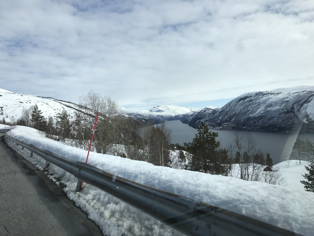
If it is of interest upload the following “kmz” file into good old GoogleEarth to know what the plan is. How it turns out obviously remains to be seen. Check out the bit between the coordinates 45.371030, 23.365490 and 44.857150, 22.387999 in Street View. Not too sure how that section is going to pan out. Be interesting if nothing else. Nothing ventured and all that. Van can’t get many more dents anyway.
planned_romania_route.kmz
File Size: 71 kb
File Type: kmz
Download File

Main preparations are complete and should set off on Thursday 31.08 plan to be back home, barring problems, by Sunday 05.11 latest. 

12th and final collection of OFR's for my 2017 trip through Norway.

3/6/2017

 
PPR-53 17.05
Start: 06:20    Finish: 14:08
Total km., for day: 238,4
Camped at: N62°16’53” E9°30’54”.
Yesterday was grand, walked morning and afternoon, did wonders for my long suffering back. Shame I can't find a Troll lady to massage my bum, it lost all feeling weeks ago, sure I must have some callus on it.
Parked up in front of Rema, the Supermarket in Tynset as I’ve run out of food and they also have a good wifi connection. Started updating the Blog while waiting for them to open. Was finished with the blog at about 9:15 and they were still closed and should have been open at 8:00. This stirred something way back in my “pea” and I ran a quick check on the web. Guess what, its Constitution Day and everything is closed. Do my weight some good I suppose, demolished the rest of my grub yesterday hoping to stock up today. That rather obviously ain’t gonna happen.
Decided to check out the Musk Ox location on my way out of here, this was a delusion of course no doubt brought on by the thought of no food until the morrow. Just have to hope my belly doesn't keep me awake.
One advantage of it being a holiday turned out to be the fact that everywhere I went the folks were turned out in their full National Costume. Very impressive!
Camp for the night is great as well, all by myself with a view over the Fjell. On the way up saw a Fox ambling across the road.

PPR-54 18.05
Start: 06:40    Finish: 16:45
Total km., for day: 258,7
Camped at: N61°05’05” E10°20’32”. Altitude 510m
Another day that proved that there is great deal of hidden Norway still to be discovered.
Woke with it raining and the cloud ceiling almost touchable. Quick check of the Musk Ox location, you never know, then turned around and headed down off the Fjell into Dombås and towards Otta. All of this on the E6 as far as a place going by the name Nord-Sel where I managed to get off of it and stayed off until a town called Vinstra where I filled up, still without a clue as to where the day was going to take me.
From there onto the 255 down to Forset and it was absolutely brilliant. I was literally in the clouds for almost all of the time but what I did see in the gaps will definitely bring me back next year. It climbs up over a 1,000 meters but does not land on a plateau as is usually the case. The road follows along the side of the mountain and is truly awe inspiring. How the folks manage to farm on terrain like this beats me. About halfway along the stretch it starts down again, steep in places and past a dammed up lake, still frozen solid and on down into the valley.
It runs off into a pretty large river and it was well and truly in full spate, what with the thaw up high and the torrential rain all day. It had burst its banks in a lot of places and on a couple of occasions was encroaching on the road. Quite alarming to be honest. Helped me make up my mind as to where I would be seeking a stop over anyway. Not near water and down low.
From Forset I had thought of going up over the plateau to Fagernes. No go, closed still lost under the snow. So I snaked around on the backroads onto what I had decided would be my route tomorrow.
Found a place to stop, must have an incredible view. Find out in the morning if the clouds lift and the rain stops. At least at 520 meters above sea level I should be safe from all of the wet stuff other than that streaming down endlessly from above.
Having looked over the map decided to make a big loop out in a westerly direction and then loop back east onto the Horten-Moss Ferry below Oslo and out via my standard route

PPR-55 19.05
Start: 06:00    Finish: 16:20
Total km., for day: 292,6
Camped at: N60°18’54” E9°12’34”, Altitude 700 m.
Logged N60°51’22” E9°11’12” as a campsite for next year. At least it stopped raining overnight and I had a quiet night. Down to Dokka onto the 251 to Fagernes, the 51 across to Gol then down the 7 until I could connect with the 287. From there up and over again, stopped off finally just before Eggedal which is where I am now. Supposed to rain for the next two days, we shall see!

PPR-56 20.05
Start: 08:00    Finish: 22:55
Total km., for day: 968,5
Camped at: N54°56’56” E11°59’11”.
Man oh Man No. 1 Sons fiftieth birthday today, wished him well then put it out of my mind, reminds me of how bloody ancient I’m getting. He’s on his penultimate day of the West Highland Way and having a great time. Well done mate.
In the middle of all my driving around this morning I suddenly realised I was revisiting all of the places that have been to many times before and find really pretty uninspiring after what has gone before. Reason, trying to kill time until I have my appointment to get the van problems fixed in Schwerin on the 31.05. Stupid bloody idea, bored stiff and gobbling up litres of what must be the most expensive fuel in Europe so decision made. As can be seen from the distance traveled today and the time it took. 13 hours 23 minutes driving time. Thank goodness for cruise control.
Crossed the boarder into Sweden at 17:23, last wild life to send me on my way was a little deer which popped up at the banks of the lake I had stopped at for a quick ten minute driving break. Lovely creature.
Back road out of Norway to Dingle in Sweden on route 22 to pick up the E6 and thats it. Crossed into Denmark at 21:50 and am camped up at the bridge again.

PPR-57 21.05
Start: 06:15    Finish: 16:56
Total km., for day: 286,7
Camped at: N53°39'38.46" E11°29’48.47”.
Straight through to Leezen near Schwerin in the hope that the guys will fix the van on the fly tomorrow.
Went first to an official camp site at a place called Seehof that we have used before and spent about an hour under the shower scrubbing all the accumulated muck off myself. Felt good I have to confess. Into Schwerin for some grub and stretch the legs then an early night.

PPR-58 22.05
Start: 05:30    Finish: 16:56
Total km., for day: 532,5
The Campmobil guys didn't bat an eyelid, they are used to me just appearing out of the blue and within an hour all fixed, part under guarantee and on my way. Drive to Düsseldorf as always uneventful and boring.
Tacho reading at home was 73,604 kilometres so the round trip was 14,113 kilometres all in.

At the moment I'm plotting all of the overnight coordinates that are to be found above. Correcting those where my TomTom decided I was parked in the sea or the middle of a road. Hoping to added them to this last collection as a link into Google Earth so for interested folks my course can be plotted. Using the PPR number and date as the references

Right I've tried various alternatives and can't be as slick as I would have liked. What you have to do if you would like to see a plot of my overnight stops is download the hic_norway_2017.kmz file that is shown under this text and open it in Google Earth. Should work, has for me! In doing this I checked each one in Google Earth and where necessary corrected the TomTom ones I had been using in the text and recorded from that device each evening. Now you should be able to see fairly accurately where I was. In some I was parked in the middle of a road, out to sea or in the middle of impenetrable forest, with a vehicle that is.
hic_norway_2017.kmz
File Size: 4 kb
File Type: kmz
Download File

In PPR-46 10.05 I mentioned a Stavkirke and thought in case it is of interest to anyone I'd include this link: https://en.wikipedia.org/wiki/Stave_church​

Finally in closing this out I have found a myriad number of mistakes, spelling being the least. Thought about correcting them but some are so convoluted I thought, no leave them be, folks can either puzzle away, laugh or whatever!

​Maybe I'll run a Blog for the planned Romania Trip later this year. If it comes about.

Thats it, a truly wonderful and revitalising trip and I enjoyed every second of it. I hope it has been of some interest to folks who have bother to keep up with the trip and that one or the other has found something of interest in it. Even if its only to decide that there is no way you intend to finish up like this crazy old fart.

​Enjoy life folks it can come to an abrupt end. Fact!!!

11th collection of OFR's

17/5/2017

 
PPR-45 09.05
Start: 06:15    Finish: 18:30
Total km., for day: 219,4
Camped at: N60°55’32” E7°04’45”.
Great nights sleep again, something I seem good at. Quite a surprise to peek out and find myself in the clouds which is hardly surprising I suppose at 600 meters, snowing as well. I took it slowly as it looked as though it might clear up for me to try for my images.
Drove down to the camp site, updated the Blog and stuff and drove down into the village in the valley back the way I’d come in yesterday to the only shop for literally miles around. Could have saved my self the trouble, I almost had more in the van as leftovers than they did. Nary mind, means I can try for my images back in as they are all on the way. Started raining during this, of course.
Going past the camp site again I dived in to take advantage of the good wifi connection to check the weather. This changed my timing drastically but not my route.
Heavy snow storms moving in over the whole area that I had planned to be whiling in for the next couple of days so I decided to scarper rather than risk getting stuck up high.
From here I have to negotiate a quite steep pass, which reminds me of the Ouzzlem Bird as the Pass is so well blessed in hairpin bends I might just finish up like him, to arrive at the Ferry across the fjord. This gives me the run into the pass up over the Fjell and back down again into Voss. Only 200 kilometres but more than interesting ones. They shut the passes down as soon as real bad weather comes in and then its wait and convoy time. Don't really need all that.
Turns out to have been a good decision as I learnt waiting at a tunnel to be driven through in convoy due to roadworks in it. Seems the area I was “fleeing” from was more or less shutting down behind me as I drove out due to the storm up above the snow line.
This stretch is a continuous tunnel, or at least that’s the feeling one gets. I’m on the E16 as there is no other possibility through these high mountains. This evening I took a sharp left coming out of an eleven kilometre long one. Where you exit it you literally just have time to grab a breath before disappearing into the next one which is only five kilometres long.
The E16 is like this for kilometres. In the morning I have to go through the five kilometre one and then a series of baby ones until you have the choice of going North. This takes you through what I believe is currently the longest one in the world. Twenty five kilometres of it. Alternatively you can go Southeast down the 50 through a series of shorter ones.
Me I’m going Southeast, we went through the long one in 2008, great piece of engineering, wide, well light etc., but as boring as hell. Apart from which if you go that way its hard to play “Who can hold their breath going through?”
Anyway after my sharp left I drove down to the bottom of the road to a small village, Undredal, on a very large Fjord. Where much to my surprise I realised I had been before  on our 2008 trip, never been able to remember where it was.
Went halfway back up the road to a spot ID’d as my overnight home, probably go into the village again before leaving for a couple of buildings.
Great camp nice and quiet. 

PPR-46 10.05
Start: 06:30    Finish: 17:15
Total km., for day: 309,7
Camped at: N61°02’36” E7°47’45”.
Once on the move back for the images then out onto the E16 and dived off down the 50. It wasn't really surprising that it started to snow and didn't stop until about 16:00.
The climb up the mountain through the pass to get up on the Fjell was truly amazing with some equally amazing tunnels. Once up on top the snow was really getting into its act and the temperature dropped down to -3,5°C, really wild up there. Hats off to the road and tunnel builders, power line folks as well.
Came down off the 50 onto the 7 and along to Gol, and from there up and over again, not as high and wild but still windy and snow. This brings you down into a small village called Borgund, just off the E16 where there is a Stavkirke, look it up if your interested, there are only twenty-eight of them left in Norway. They are really old wooden churches, quite amazing old things.
Start heading North again tomorrow I’ve decided to go via Dombås and over the Dovrefjell. There are Musk Ox up there, not that I’m likely to catch a glimpse.

PPR-47 11.05
Start: 06:00    Finish: 15:26
Total km., for day: 271,8
Camped at: N61°52’27” E9°05’56”.
Up early and moved a little closer to the church for breakfast as I was camped somewhere I shouldn't have been.
From there about eight kilometres down the road to a truckers stop to use the WC facilities the local authorities provide. Get to wash and brush up with hot water and in conditions slightly less cramped than in the van.
After that off on the route the SatNav had planned, and I’d approved, until she started to take me up a mountain on uncleared gravel roads. Gave her the rest of the day off, switched her off for a rest. Bit too hairy what she was asking of man and material and I chose my own way.
At Fagernes topped up on all the necessary fuels, diesel, water and a cuppa cocoa and good to go for fair while again. Picked up the 51 which up and over the pass onto the Fjell. Incredible amount of snow up there but the road completely cleared. Most of the peaks are over 1,500 meters plus so hardly a surprise. That drops down into Vågåmo, an interesting little town, boast its own Stavkirke from 1,100, and was a favourite place of Edvard Munch for the artists amongst you. The Scream?
Spent sometime walking about, back starting to give a bit of gyp. Camped on the large Parking area at the entrance into town. Lots of wonderful opportunities up on the Fjell, but everywhere it was possible they had put up big unmissable NO CAMPING signs the buggers, so didn't have much choice.
Got quite an interesting route for my drive out of this great country, just have to see how it pans out.
At least this spot is quiet, maybe because it backs onto the Kirke Graveyard.👻

PPR-48 12.05
Start: 06:15    Finish: 14:15
Total km., for day: 171,9
Camped at: N61°58’45” E10°01’32”.
Milk off, no breakfast, what a bummer.
Unbelievable camping spot off the 27 near Folldal, its right off the road in the trees and bush in an area with quite a few clearings with campfire sites right on the river. Guess its popular with the Angler folks in season.
When I arrived sun was shining temperature about 8°C so I grab the chance and threw open every door, cupboard and any storage areas and took out all bedding, fleece jackets etc., and gave everything a good long deserved airing. I have a vague suspicion that the interior smelt a wee bit like and animal transporter. Really hasn't been a chance before to do so.
If the weather is like this in the morning might risk a quick skinny dip in the river and wash properly.
Van all packed and closed up by 18:00, sun disappeared behind the mountain and it cooled off pretty quick then.
The normal route out of Vågåmo takes you down the E6 which is the worst Euroroute of all, it serves as the main arterial road straight through Norway, South to North and every Tom, Dick, Harry and all their relations use it. So I just told Kate take me here but DO NOT USE the E6 to do it. Great move, didn't touch it once, she took me mostly up on the hillside high over the E6 on the other side of the river and all the way down to the 27, which is where I wanted to be.
The 27 took me where else than up and over another Fjell. Plenty snow again, too much to get off the beaten track but found a grand spot for  a good old Omani style Mountain and Desert trip lunch. Sardines in oil and dry bread. Unfortunately not the Omani bread.

PPR-49 13.05
Start: 06:45    Finish: 17:20
Total km., for day: 197,5
Camped at: N63°04’12” E9°53’18”.
WOW, it was cold in the night, ice on the inside of the van windows when I woke and the ground temperature was -4°C. I am more than snug in my sleeping arrangement so didn't notice. Did make me change my mind about a quick wash in thriver though.
It soon warmed up as the sun came up and a wonderful run up to the E6, which unfortunately is the only road over the Dovrefjell. Where the road starts to go down towards Oppdal there is an old way station on the right and a bit further on the left an old, but in service, Railway Station. About 100 meters before the way station I nearly fell off my perch, I had difficulty in realising my amazing luck. Two Musk Ox grazing away. There are about 200 hundred in Norway and they all roam about up here on the Fjell and are rarely seen and very shy. Outside of seeing them in animal documentaries I never thought I’d get to see one in the wild. Grabbed camera, 200mm lens and a 2x converter. Lets hope!
After that into Oppdal tanked up again and left down the 70 until I could hang a right. This I did and the whole way until this stop, which I cannot exactly locate on the map, but have the coordinates, I was in my own little heaven, dirt roads all the way, camped off it as well.
Just off a bridge with a rapids hurtling through under it.

PPR-50 14.05
Start: 07:00    Finish: 18:25
Total km., for day: 301,6
Camped at: N63°11’18” E11°09’18”.
Not a bad night considering the noise the rapids made. Loafed around a bit just enjoying some sunshine and the location before heading off and down to where I connected with the 705, dirt all the way but good eighty kilometres in all. Changed my route on a whim and decided to shoot up to the Swedish boarder. Mistake was a lousy run, E14, all the way up to the boarder I kept feeling some things were vaguely familiar until just before the boarder two signs, fairly close to each other gave my memory a wee bit of a nudge and I decided to investigate on the way back down from the boarder.
On the way back I checked out the signs and sure enough I had been through this way before with Brigitte on our last trip up here. Only we had come down from up North, Narvik I think, via Sweden and had been going in the opposite direction back into Norway.
The second sign I followed took me into the location of an interesting “Wooden” Dam, and Lake. It was where we had camped last time. So I had my lunch there for old times sake.
On the way back down to where I could exit the E14 all sorts of things suddenly slotted into place. Amazing how the direction of travel makes such a difference.
Where I have landed for the day is about where I had planned for my jumping off point on the drive down south and home. Kate was making a real dogs breakfast of finding exactly where I wanted to be so I fired her and headed up into the hills and found a suitable abode.

PPR-51 15.05
Start: 07:00    Finish: 17:50
Total km., for day: 279,4
Camped at: N62°16’24” E10°46’25”.
The day was everything other than planned. This was to explore the very interesting looking small roads between the 30 and the Swedish boarder. It turned out to be an absolute no go for two reasons:
  1. They are either private roads, toll roads or both.
  2. More importantly they do not open until the beginning of June, earliest.​
My own stupidity as usual, the toll bits not a problem, the private is, but the fact that they are all at an elevation of 900 metres upwards in an essentially unpopulated are should have been obvious. Ah well!!!
These images will help to support the facts, at least to point 2 anyway. The first image is the view on the righthand side of the van and the second the lefthand side. I was on the only open road through the area.
Instant switch to plan B and off down the 30. Saw plenty of interesting stuff, one was a very large and handsome looking Elk who was taking a break in a lay by, until I showed up, and one very startled and frightened deer, with antlers I might add. He was stood in the middle of the road in a curve and if I hadn't hit the brakes full on both he and the front of the van would have looked quite sorry for themselves. He took off with rather relaxed set of  bowels into the trees, thank goodness. Also spotted a lot of Goosander on a lake and a Grey Plover, yes I am sure, and he was a long way inland from where he was supposed to be.
I finally landed up in Tynset again on this trip as fool that I am I couldn't find an excellent and remote camping place that we have used before.
Camped on the parking lot close to the railway station which turned out to be pretty noisy up until about 2 am., due to all the boy racers giving it stick all over with Harvey Wallbanger style music blaring out at Trini Maxi Taxi volume. Even my van metalwork was vibrating with it. I just hope the were Daddies vehicles and that they bent them before they got home.
All in all I had a good day but one that can be categorised as an “Oh, I think I’d better think it out again,” day. I enjoyed it all the same.

PPR-52 16.05
Start: 06:00    Finish: 09:20
Total km., for day: 28
Camped at: N62°25’36” E11°05’27”.
Very short day and one that reinforces the fact that I’m and idiot. I could get no peace over not having found the camp site I had wanted so decided I would locate it before moving on.
Easy explanation I had it in my head that it was off the E3 just outside of Tynset going north to Trondheim,. It’s off the 30 just twenty eight kilometres, as you can see from todays kilometre tally, just before coming into Tynset from Røros, passed in on the way in last night. Oaf!!!
So here I is, and here I stays, it really is a lovely spot so no more driving for the day. Chance to catch up on the blog and do some walking for the back, it really does need it.
There were plenty of places with wifi connections in Tynset, which I have to drive through tomorrow, that should be good enough for me to make another post.
Most important part of todays post, wildlife seen, Mouse out on a bridge pontoon in the middle of this rather large river?
Bugger, sitting outside of a large Supermarket doing this 17.05 at 09:00 and wondering why they are still closed. Opening time is 08:00. Jest checked on the web, todays a public holiday. Someone is going to be bit peckish by the end of the day.😕


NOTE TO BLOG POSTS:
This will be the last one before I’m back home I think, the last two weeks I shall be flitting about all overrun my way going down south trying to find places I’ve never been to before, need some Brownie points with the Boss who wants to come up again next year for a bye-bye visit. I think Norway has been pretty well covered by us, both together and alone, over the years, and they are telling a bit on the driver as well.
I shall be doing what I have done all of the trip and keeping notes for the sake of completion and my own personal record of what, when, where and I shall post them for those that are interested on how I found my way home.
Stop before last will be the first stop as on the way up. With the guys that put the van together for me to get the electrical trip switch replaced and that is bridged out at the moment.
I’m with them on the morning of the 31.05 so don't be expecting anything much before end of first week in June.

10th collection of OFR's

9/5/2017

 
PPR-40 04.05
Start: 06:45    Finish: 17:26
Total km., for day: 207
Camped at: N62°07’47” E6°14’21”.
Woke at 5:00 but crashed out again until 6:45. Moved off at about 9:00 and by the time updated and posted the Blog it was 10:00.
Turned out to be a confused but fantastic day. First off I became really annoyed with the Road Toll System, not because I object to having to paying, although the way it is organised it’s a straight rip off. No simply because the way they do it, and they do it rather effectively, they want to force you into using the main highways.
Stir me being who I am I persevered and found an incredible drive and some great camping spots to boot. The one I wanted to use I left for now as its in a complete mobile signal blackspot which as the Boss is in Hospital back home for an OP I didn't want to risk not being contactable. maybe I will be able to work things so that I can come back through after my Rock image thing and the all clear is sounded from home.
Might be a bit difficult though, I’ve been browsing my map here where I’m camped for the night and have found all sorts of exciting alternatives to my original idea. Sure I ca, we shall see, after all they are only kilometres after all. Hate to think what all the fuel is costing for this traipsing around. Leave that until at home and can't change it then,👹
Camped up out in the boondocks here, looks like the cleared area I’ve chosen is a loggers collection area. Hope I don’t wake up in the morning to find they are early starters and have just taken delivery of a large amount of logs.

PPR-41 05.05
Start: 06:30    Finish: 17:30
Total km., for day: 288
Camped at: N62°06’13” E5°16’07”.
My mate Dieter comes under the knife today. Thinking of you Buddy and you get up and bounce around again ASAP. Please!
Spent quite awhile driving without a clue where the hell I was but finally found out I was on the 651. Nary to worry and my own fault for diving off the road I was on to avoid a long tunnel that suddenly loomed up ahead. Later in the day on a break and a lot of rooting around on my raging maps found the road and how I managed to get on it. Either way no harm done, rather the opposite, another one for the list. Tremendously interesting and scenic as hell.
Now back to what has been one of my prime objectives on this trip and this was too get to see the Kannenstein. For anyone that is interested and wish to know where it is located it can be found at 61.96873323N 5.0673580169E an what it looks like this is the first image shown below in this post.
I guess it is about three meters high and just a lump of rock on the shore at, you've guessed it, Kannen. It has all hell beaten out of it over who knows how much time, by stormy seas and fellow rocks blasting away at it. I originally saw an image in a Photographers exhibition, in Black and White. It appealed to me so much I contacted the guy for it’s location and decided “This rock I have to see”.
You folks having seen my iPhone version of it will probably only have your opinion of me as not being all there confirmed, but I can assure you the ride in to see it is worth the effort.
From there started back on a route which will take me back to where I got all gooey about yesterday, (Boss is back home and OK), so having no phone contact not a problem anymore. The little ferry that I need to catch to get across to it doesn't run Sundays so if I don't take the chance tomorrow it'll have to wait until next year. Devious little me has discovered another baby Ferry that I can loop around to and get back to including all the other exciting things I mentioned yesterday. It’s only a detour of 400 kilometres. Hi Ho life just a bundle of fun, I haven't a clue why I spent all those years pretending to be working.
Landed up on a pass crossing from one side of the land mass to the other, about 500 meters up and quite breezy but with views forever.

PPR-42 06.05
Start: 05:30    Finish: 12:00
Total km., for day: 214,8
Camped at: N62°08’34” E6°44’41”.
Bro setting out on his Irish Atlantic Wall ride today. Have fun Squire and stay in the saddle.
Quick breakfast and on the move pronto, wanted to be sure of making the ferry, which worked out just fine. Made it for the 11:10, one after that as 12:45 so had some luck.
So now I’m back on the spot I’ve been all excited about, truly beautiful and serves to remind me just how pitifully tiny we really are. At the same time to have ones nose rub into the fact that to really enjoy it you have to get up into it, which is unfortunately no longer a physical possibility. Observation not self pity, fact of life, imagine whimsical sighs echoing down the valley.
Had a great lunch sitting in the sun enjoying my surroundings. Baby spinach (triple portion) and a 300 gramme chunk of smoked salmon.Main reason for that is to ensure the I don't have the same problems tonight as I did yesterday.
I as so finished after all the driving I couldn't be bothered to organise a decent meal so had a slice of bread with a bit of tinned Mackerel  on it, followed by a piece of bread with Reindeer Salami on it and for desert two slices of bread and honey. Seems they didn't seem to get on too well together and wage war al night long.
Will enjoy the rest of the afternoon walking around and watching, quite literally, one big avalanche after the other thundering down on both sides of the valley.Really spectacular if your far enough removed , which needless to say I am, (He hopes).
In between all that hard work have been doing some route planning for the rest of the trip, cant leave it all to poor old Kate, or is it Jane.

PPR-43 07.05
Start: 05:15    Finish: 16:20
Total km., for day: 276,6
Camped at: N61°49’32” E5°25’32”.
Woken at 5 by an avalanche and as I write it’s 8 and they haven't stopped yet. Also heard a couple in the night but didn't disturb much, pretty much like thunder.
On the road at 8:30 and fairly early at screwing things up as well. That’s what you get for getting cocky I guess. I went right instead of left and landed in Volda which is exactly where I didn't want to be sixty kilometres in the wrong direction. No worries, don't have a timetable to keep to. Filled up with fuel, water, check tire pressures and have a sneaky cocoa. Back the way had come and round to the ferry I was aiming for. Only had half am hour to wait and away again.
An interesting drive but a only to done once I think. The whole area consists of an almost sheer sided mountain range and the roads follow around at its base along the sea shore. Well more or less and there are no roads at all into the interior areas. So anything inhabitable, is inhabited, obviously, and by the rules of wild camping cannot camp within 300 meters of any building, even if its a shed on the property perimeter. Thats one rule I always keep or err on the positive side of. Being able to camp where you wish is for me is a privilege and I don't wish to be one of the ones ruining it. Only one camping place in the whole area and it was not open.
Did not really matter as when I arrived where I had thought it would be great to camp, right out on the point at a place called Kalvåg, turned out to be more than breezy, howling would be moral like the correct term. If your interested in where it is put these coordinates into our friend Google thingubmegig, N61°53’23” E5°15’31”, where I ha my lunch, and follow the road west as far as it goes, route 616.
As I’d been counting on camping out there anyway, “cos its a dead end according to the map and I had planned to go back out the way I’d come in tomorrow. Started to do this and  coming over a bridge I spotted what I thought might be a possibility to park up for the night, no luck. What was lucky though was as I was coming back off the area I spotted a sign which said 20 Km., to Svelgen my targeted end for the day no matter what. That cannot be right I thought that road leads to a place named Bortnen which is a dead end. For a change I figured they might know better than myself so I took the road. Twenty kilometres instead of over eighty is a good argument in my book, especially if the sixty of them are on a single track road with passing places.
Turns out the were right, in Bortnen the road just kept on. They'd put a hole straight through the mountain and zimzalabim there was a brand new tunnel. Nice surprise. I emerged approximately in the middle of the stretch between the ferry at Isane and Svelgen. I figured the place along that stretch where I might find a spot to camp was a few kilometres back up the road to the ferry and a few more clicks in the wrong direction weren't going to kill me and I took the chance and was right. It turned up 4 kilometres later on the edge of a lake and mister was lord of all he surveyed again. Well that is with the exception of a whacking big truck out of Czechoslovakia , so I let him stay. Great spot and absolutely quiet. Guess the trucker was on his Sunday break and he slept all the time I was there.

PPR-44 08.05
Start: 08:10    Finish: 17:15
Total km., for day: 255,9
Camped at: N61°20’09” E6°24’02”.
Nice slow start, finally crept out of my pit at 8:10, trucker gone, didn't hear him leave so must have slept well.
Started off on an easy run as planned, stopped about 13:00 for lunch and moved on. On the way to the stop checked to some 8,000 year old Stone Age rock carvings, more than 360 of them an a section of smooth rock carved out by a glacier. Fascinating.
I broke off the second leg of the planned route for the day as it was nothing particularly exciting and a dead end too boot.
Got back onto the 13 which was also on my planned way out and am camped up with the views left and right as shown, which is at 600 meters above sea level I note on my gizmo.
It’s pretty close to an official campsite we have often used, Saw the guy who owns it yesterday and I can use all his facilities and wifi, which I hope is good enough to allow me to post this. Which is great ‘cos I get to camp further up the pass.
Some interesting old buildings on this stretch and will stay over two nights and try and make something out of them.
The last two images below are left and right of my camping spot.

9th collection of OFR's

4/5/2017

 
PPR-34 28.04
This an addition to above PPR-34 post Post as it were.
I was in and out of the dealers within the hour and the cost was not too bad. NOK 350 which is about €44. Probably have cost the same if not more in Düsseldorf.
After that I went across to the CircleK for my cocoa, of course, and worked out what all the different buttons on the car wash bay were and gave the van a very much needed wash and brush up. Exterior only, unfortunately no vacuum there. Shame I’m knee deep in crumbs and things inside. I’d tried a couple of times earlier on but the roads were in such a state it was just chucking money away.
Now I’m below the Arctic Circle the roads are clear and no more snow and stuff to get us dirty, or not very.
Still once we were all bright and sparkling set off feeling better with no problems on the van and had a slow run to the coordinates above which I’ve added with this revision. Of the road on a Fjord and a bridge over it. As always after about 19:30 to 20:30 no traffic at all.

PPR-35 29.04
Start: 05:30    Finish: 14:04
Total km., for day: 234,6
Camped at: N63°29’12” E9°59’49”.
Awake early as wind came up a bit heavy and was whistling through my rigging. It was following on behind the sunrise, which usually brings a wind with it. Not really a problem as I’d crashed the night before at 20:30 as was knudgered.
Easy run to Brekstad to check the Ferry times for Monday. Needn't have bothered as I changed my mind as far as Monday’s route is concerned almost as soon as I had the times.
Either way I’m here until Monday morning, invited to the friends here for breakfast and a look see at the caravan they have just picked up from Denmark.
Need a rest from driving as well so that won't harm.

PPR-36 30.04
Rest day, breakfast with Ingrid and Robert, made themselves a great deal on the caravan. After that just loafed around in the marina and chilled.

PPR-37 01.05
Start: 06:06    Finish: 13:58
Total km., for day: 186,6
Camped at: N62°50’09” E8°40’08”.
Day of reckoning, old Credit Card expired yesterday and the new one kicks off today and I’m hoping it does so without any hiccups. I’ve got to get the Ferry back to the Trondheim side of the Fjord and immediately go into a whole series of Toll Roads which the clever buggers have worked so’s ye can’ne avoid ‘em. Shouldn’t be a problem but who knows where Murphy's spending his time.
Both Toll account with EPASS24 the Swedish outfit and EPCplc which is the Norwegian rep., and cashier so everywhere else should also be fine, and ’twas.
After all the usual leaving preps in the Marina, me washing, dish washing water canisters etc., up and away.
On the way to end stop for the day found another likely place, but decided to leave it for next year with the Boss. Checked ferry time at Kavanne and back to this spot an old favourite and will sleep the night here.
Tomorrow before leaving will go back into the interior if the road is open and if so hike in to the waterfall back there.
But for today that’s enough.

PPR-38 02.05
Start: 07:00    Finish: 16:30
Total km., for day: 127,2
Camped at: N62°42’54” E8°29’38”.
For my raging memory the coordinates at the setting out for the waterfall, and various other epic and heroic “hikes”, not for me no more the hikes is a place called Kårvatm. It’s in a National Park. Anyway they are N62°46’51” E8°52’24”.
They’ve done a bit to the dirt road since I was last here, but not much.
Waterfall not possible for little fellas, and for that I am in possession of the required qualifications, snow still far too deep.
Easy drive back to village and found some great images that fit my project Theme and stopped where I had camped for lunch.
Made the 13;30 ferry and a slow stop start drive down to Sunndalsøra. Main item there is the Hydro Aluminium Works, which is really what the place is all about. They built it here way back up at the back of the Fjord because of their electricity requirement. They are at least 100 kilometres plus inland on a Tidal Fjord, imagine. Anyway the produce their own power from the vast amounts of water that come thundering down out of the mountains all year around.
A lovely setting, with exception of a bloody great big works, but even that is VERY clean and fits in, certainly not the sort of place old Industry Soaks like us are used to. With the exception of El Palito of course, not many Plants have their Northern battery limit right on the Caribbean Beach.
Diesel and cocoa as usual, a couple of failed attempts to find the entry point again to an incredible rout into the interior that we made in the T5 in 2008. It loops up through the mountains and onto the Plateau, which is where the vast natural water reservoirs are that Hydro taps into, (check it out on Google Earth its immediately south of Sunndalsøra, you can see it all I’ve checked) all 4x4 stuff but the T5 had no problems. Think I found it again at last, it was after the town going along in my travel direction.But didn't bother to let myself be tempted into having a look see. The full route is over 75 kilometres and is excitement and ooh’s all the way. Gotta do it one more time.
Just after it a bloody long tunnel loomed up but not for Jimmy cries I, I’m a right clever sod I is, I’ll take the old road outside around and over, much more pleasant.
Turns out they count on clever SOB’s like myself and just as one gets to the highest point of the traverse, before heading back down, they have put up rocks like tank traps in a double row, and just in case there are some even more sneaky ones amongst us the figure they can beat this they put in Catch 22. A large wide and deep trench. Gotta give it to them, points to them.
Didn't bother much anyway as right next to it there was a dirt road ramp leading up to a Communications Really Station, great it is the highest point as they usually are, totally secluded with views up and down the Fjord and of the mountains. What more can a guy ask for. My home for the night, that is if the wildlife doesn't disturb.

PPR-39 03.05
Start: 05:30    Finish: 16:45
Total km., for day: 243,7
Camped at: N62°34’07” E7°43’19”.
Must have had too much kip the day before, was awake at 5:00 and gave up and got up at 5:30, why thrash around. On the road early as well, naturally.
Meandered all over the place and picked up the exit point of the route over the Plateau mentioned above. This time i did follow it right in until Asphalt turns to Grit, and that is where it turns into big boy stuff. One can see the road starting its zigzag route up until somewhere it disappears into an incredible tunnel I’ve told some of you folks about before, it is a spiral! Again my pea sized one boggles. Anyway from where I stopped you could see the that the zigs and zags were piled high with snow, and up on top the snow cover is complete.
No way I was going to risk a sneaky look up there, and that on my tod. I know a couple of Herberts’ who pulled a trick like that once, only it was in a sandpit, nobody new where they were and the same is true here. Only good thing about trying here I guess only one goes missing.
On the way back out found a nice sunny spot surrounded by the great mountains and had lunch. The whole time I was stopped you could hear the crack and boom of the avalanches coming down all over back up in the mountains. Next year fo’ shure, without the snow of course.
On the way to my days destination of Åndelsnes, I wandered off onto the 666, I think, was not in my direction, but whats direction count between friends, finally got back on track but not before I got caught behind a farmer, his tractor and his very leaky water tank, all of which trundled along at tractor speed for quite a few K’s with no chance of overtaking. After awhile though he dived off the road into his field which he then diligently started to spray with this very evil looking brown coloured liquid, which of course you will have guessed by now wasn't water. Since when I’ve been followed around by this very “Rural” Farmyard Aroma. Got me quite a few strange looks when I parked up in Åndelsnes to stock up on grub. ‘spose I’ll have to wash it in the morning as it doesn't look as though there is much chance of rain to save me the effort.
Thats me for the day. Will stop off at the Tourist Info at the Railway Station here they have what looks like a good free Internet connection, so a post is on the cards.

The following pics were taken at the last two camping spots, The stair is the one Neil Armstrong was referring to I think. Next two was the view early in the morning looking across at mountains as usual. Hard to tell where up is sometimes. Just had to include the Trolls breakfast table, they'd just left unfortunately but you can guess at the size of the table from the bog standard flowerpot on it. The pebbles around the pot are used to attract the waiters attention, I'm told!

The last set four are from up on the Relay station I mentioned. Just above the tree line in the first of the four you can see the Aluminium Works, second is down towards the sea which is over a 
hundred kilometres away, hard to imaging this water is tidal.

8th collection of OFR's

28/4/2017

 
PPR-32 26.04
Start: 06:00    Finish: 19:40
Total km., for day: 334,5
Camped at: N66°58’52” E15°18’55”.
Up and about bright and early, suns coming up nice and bright behind the mountains. Drove slowly out the way I came in, no other way. Started snapping iPhone pics to try and give a rough idea of what’s to be seen, as my Bro asked why I’m not posting any images. The scale of the scenery of the landscapes is such that I’ve three main reasons for not doing so:
  1. I’m not very good at it.
  2. One alternative is to make panoramas, which I hate and you finish up with a wide skinny image, at lest I do anyway.
  3. The only way to do the place justice is with a large format 8”x5” camera. Disadvantages of this way are the gear is big and heavy, and so is the price. Can’t really justify that sort of cash, plus the lady back home might just not turn out to be so understanding if I came home with a piece of gear like that.
Lat year one of the photographers I met on the Lofoten, a professional, had been talked into buying one at the Photokina Trade Fair in Köln, thats the big Imaging one that comes around every second year. He got a good reduced Trade Fair price he said, €55,000 he paid for it but that’s serious brass. Lovely bit of gear though.😋
As soon as I get a connection I’ll post the few I’ve snapped. Thanks for the comment Bro.
Once you get out of this little bit of paradise it’s back on the E6 towards Fauske and it is a terrible road. The Norway version of a motorway.
I did manage to find an interesting diversion about a third of the way there. It is possible to dive off to the right onto an old B-road which leads to Styrkvika. It’s a dead end like so many of these diversions but worth it and with views to I’m not very good at it. home about. Fortunately it is not necessary to drive the whole route out as there is another little road that sneaks back onto the bloody E6 and into Fauske. After changing my plans so many times my friend Mette made time of from work and took me home for a meal and oh boy I was also allowed to use the shower. She served up a scrumptiously delicious fresh caught cod, served piping hot out of the oven. Beats the hell out of my cheese, garlic and onion sandwiches We had until 19:00 when she had to get back to her day and I metered the bit to the bottom of the route up over the Arctic Circle and parked there. Same place I was at on the way in, the one where all the Truckers leave their motors running all night.
Had toyed with the idea of sleeping up top then decided, as usual, discretion is…..! Don’t really know why but this bit up and over always gives me a special kick.

PPR-33 27.04
Start: 06:30    Finish: 17:58
Total km., for day: 456,5
Camped at: N65°04’59” E12°05’17”.
On the road by bout 8:30, in Mo i Rana at 10:45. Wonderful going over the top, was about 9:15 when I hit it and the sun was quite warm by that time, but even so the van was showing a road temperature of -6, so I’m glad I decided to sleep at the bottom of the hill last night. Then on to Mosøjen, where I took another break on the camp site I used on the way up to use their connection and made the last post from there.
From there the plan was to carry on down the E6 until the junction with the 76. About 35 kilometres down this I had spotted  couple of buildings that I wanted to photograph. After which I was going to camp up, some nice spots there and proceed tomorrow. But someone must have moved them, I’m damned if I could spot them and by the time I gave up and accepted that the mighty mouse had cocked it up again I was almost in Brønnøysund where I wanted to call tomorrow to stock up on gas cartridges for the cooker.
Ah well methinks get the gas and head down towards the ferry at Vennesund and camp up. No camping possibility and in no time at all where are we? Anyway the ferry arrive more or less immediately and across we went. From there it was only eighteen kilometres to the same spot used on the way up. Which is where I write this update.
Should have known it was going to turn out to be an odd day. Last night as I was getting ready to turn the van into a bedroom I managed to cut my finger, no idea how, perhaps too much starch in the sheets. Not wanting to put blood all over the place, so with a great deal of care, love and tenderness I applied a plaster to the damage. Couldn't think why the plaster wasn't working until a check showed that the reason was quite simple. I’d applied it to the next door finger. On that note goodnight. 🤐
The idea tomorrow is to head to the Trondheim area to arrive about Sunday to see my friend before continuing on my rather erratic way. lets see what actually does happen.

PPR-34 28.04
Start: 06:30    Finish: open
Total km., for day: open
Camped at: N°’” E°’”.
Interim update for todays date, early up, sorted out Norwegian and Swedish Toll Payment data and set off. Warning light, driver side headlamp had also resigned. So Namsos was the next big place on my southerly route and know it has a VW Dealer. Which is where I’m sitting waiting for a replacement. They are pretty good throughout Norway, foreign registration so overtime I have need it they have come up trumps. Ask me to repeat that after I’ve had the bill. Can’t be that expensive, can it?
Never mind it is law to drive 24/7 with dipped headlights here and it’s probably cheaper to get the bulb than pay any fines.

​

7th collection of OFR's Posted in Mosjøen

27/4/2017

 
PPR-29 23.04
Start: 08:00    Finish: 16:27
Total km., for day: 140,9
Camped at: N67°59’17” E15°58’18”.
Boy did I have a good sleep. Just before leaving I checked the period of the Battle being commemorated and it was 09.04 to 09.06 1940.
Went into town first and spent ages looking fr a good internet connection. finally found one at the VW Dealer that fixed my duff starter motor on teethe last winter trip I made unto Tromsø, so I dod a quick update and post.
Finally got back on the road about 12:00. Decided along the way that I’d break and camp at Ballangen. This is thew same site I was on when the starter motor resigned. The guy that runs the place recognised me from back then and offered to let me just use the facilities to shower, fill up water canisters again instead of having to camp. dod lad, didn't want paying either.
Did I enjoy my shower, first real wash worthy of the name in three weeks so I suppose it was a bit overdue. I must have used up all of the hot water in the neighbourhood. Squeaky clean now though. Figured the as I was clean I could treat myself to a change of bed linen as well. Only got the one change with me anyway. Water on board and HiHo on we go again. Smelling like a garden of roses. I got to the ferry that sets you across in Bognes just in time and carried on down the road awhile before calling it a day here. It is actually at the other end of the small lake that we camped on on our first trip way back in 2008. Couldn't use the original spot as the van doesn't have enough ground clearance. Could only do it last time in the T5 as with the pneumatic suspension I can in case the clearance quite a bit. Shame really as it is were the river cascades in a series of waterfalls into the lake.
The lake is still frozen over and there are Elk tracks all over it and this is way out in the wilds, so fingers crossed again, just no breath holding.
Didn’t have to hold my breath,at about 21:40, still pretty light then, two fine big specimens came crazy past immediately adjacent to the van. Then I did hold my breath and they ambled off in their own good time. Chuffed I was.

PPR-30 24.04
Start: 09:00    Finish: 17:36
Total km., for day: 204,7
Camped at: N67°58’12” E14°58’09”.
Fair early start and off down the E6, no alternative here, until just after exiting a short tunnel it passes through a village named Sagelva and just after that hung a right onto the 835. After quite a short distance this disappears int an eight kilometre long, straight as a plumb line, tunnel which throws one out at the other end in fairyland. This is a part of Norway that I and most other tourist I would imagine, don't know exists. Truly amazing piece of real estate. Endless, constantly changing scenery, water, snow covered mountains, fields. forests. You name it, its there.
Followed the 835 round to place called Bogen and across a bridge onto an island going by the name of Engeløya. It is completely mountainous and the road trundles around the foot of them as well as the island.
A great deal of history here from what I could read from the Tourist info boards right back to Stone age. Brilliant walking area, unfortunately all steeply uphill. Not yours truly anymore. Shame.
It also has, like so much of Norway have a sinister side to it. You guessed it Adolph and Friends were at work.Right out on the point they built one of the largest coastal fortifications in Europe during WW II, when else?
It was home to three of the world’s largest land based canons, each with a maximum range of 56 kilometres. My little Pea boggles. Built to protect the shipping lane into and out of Narvik, which is where his steel from Sweden was exported, and naturally built by, mainly Russian, POW’s. Seems these poor folks were dropping like flies at the rate of ten to twelve a day.
The installation, of which only the foundations are remaining, are accessible and when I got up there I fell of my perch. The view is nothing less than gob smacking. It is across the Vestfjorda and the entire Lofoten mountain range, a continuous unbroken range of big snow covered Johnnies. From the southern most tip right up to where the range turns east towards Narvik. Seen in one piece like that is fantastic, no wonder I was goggle-eyed the whole time I was over there. A 
quick check of my tatty old map indicates the range, that I could see, covers almost three full degrees of latitude, however much that is in kilometres? Anyone know, I’ll have to look it up next time I get online.
I could hardly tear my eyes away but when I did I found a place to camp in the lee of the outcrop on which the southerlies battery was built. If anyone interested input the coordinates above into Google Earth, where else, the three foundations of the canons are to be clearly seen. The Battery goes by the name of “Batterie Dietel” probably named after some Wehrmacht Squaddie I suppose.
Camp site was great, totally overrun by ME all be lonesome. 

PPR-31 25.04
Start: 06:00    Finish: 14:40
Total km., for day: 220,5
Camped at: N67°55’16” E15°25’09”.
Bit parky in the night, but not a problem and I set off at about 8:45 and by the time I stopped there is not a corner of the rest of the area that can be accessed by a vehicle that was not accessed. All fascinating and full of interest but I definitely would not like to be here in the main Tourist season. But thats not likely as I find that at these high latitudes, winter is the best time to be here. All the snow adds to its grandeur and takes away, in my mind, some of the dark threatening mien they present in summer.
I’m suffering little with the views where I am camped, leave a lot to be desired, I think you'll agree when you see the iPhone snaps below. Miserable to say the least, just have to suffer I suppose.
Oh, I nearly forgot. Saw another rather impressive Elk this afternoon on the way out. Been lucky this trip with these fellows, whats the feminine for Fellows? Had trips where I finished up thinking all of the “Beware Elk” street signs were a Tourist gimmick to get us to come and visit. I am not complaining.
The above are just a quick hodgepodge I've thrown in to demonstrate what I'm having to put up with. Click on them as usual for a bigger image.
Gotta move on for today, I'll try and add some comments to them next time to relate them to the posts above. 

6th collection of OFR's. Posted in Narvik

23/4/2017

 
PPR-27 21.04
Start: 08:00    Finish: 16:38
Total km., for day: 238,9
Long lie in until 8:00 and once organised had another look around the emplacement, the lower area, did not bother with the barracks etc., up on the hill in the woods.
Then set of at 10:30 and had a long wonderful but bumpy ride. Glorious scenery, probably more impressive than later in the year because of all the snow. White Tailed Eagle, really big adult and mucho reindeer.
Had thought of finding a place to park up in Finnsnes but they have the town locked down for that sort of thing. Nowhere I could find without having to pay their extremely high parking fees, and then only for two hours at a time. Fair enough really when one considers that it is on a main tourist route and during the season extremely well used.
Anyway I drove back out of town the way I came in for about thirteen kilometres to a rest are, with WC if you please and thats where I put up home for the night. Lovely spot right on the water looking down the fjord towards Senja which is the destination for tomorrow. Only twenty clicks and one is over the bridge and on the island.
The rest area is at N69°10’28” E18°05’00”.
As I said very bumpy tortuous trip, took six hours to drive the 239 km.

PPR-28 22.04
Start: 05:30    Finish: 16:00
Total km., for day: 328,5
Snowed overnight, enough to have the snowplow pass twice in the night.
On the road fairly early, about 8:30 I think and drove right around Senja, wonderful views but impossible to get off the road just too much snow, need skis, skidoo or snowshoes, none of which I own. All along the rout the snowplows were out all over. met a coulee of dicey bits but nothing spectacular.
Pretty much the same as our last trip in 2008, anything possibly like a wild spot to overnight all under the snow and the official camp sites are all still closed. So back to Finesses for the cocoa and fill up with diesel and away again.
I’d worked out an out of the way B road route again in the general direction of Narvik, which is where I wanted to arrive sometime on Monday. However for unknown reasons Kate and I got it wrong somehow. Kate living in my SatNav btw., and we found ourselves not the back of beyond as planned but popped out onto the main E6 drag about halfway to Narvik.
What to do, sigh words with Kate and f’it drove the other half to just before Narvik. One must remain flexible.
N68°27’10” E17°28’37” which is a War Memorial site for those that fell in the battle around Narvik in ’42.
It is also right next door to where they are building one of their enormous suspension bridges across the fjord. It is amazingly interesting and I’ve always wanted to know how they went about it. Now I know.
Right for all you geography whizzes you will have realised that I have stopped my northerly direction and from here on it will all be down hill to Düsseldorf at the end of May.
The roads on Senja were on the limits of the Van tyres and it gets worse ny the mile the further north you go from there, and one close inspection of a ditch suffices. Not really missing out on anything the rest of the northern part has been covered every  which way on two other, separate trips so quick visits by friend in Fauske and Trondheim then a lazy trip out through their magnificent fjords.

5th collection of OFR's

20/4/2017

 
PPR-24 18.04
Start: 07:00    Finish: 13:15
Total km., for day: 120,6
Woke up and a nice snow storm was having its way with us. Campsite is a bit exposed so I packed up and headed for the Hotel, parked there, had breakfast and posted the latest blog entries.
Decided to take the chance and head for Sortland which is to be my last island of this group having swapped everything around. Bit of an epic with all the snow and my tyres. Conditions certainly had me doing the brick thing. Still made it without problems parked up at 13:15.
After the obligatory cocoa at CircleK, filling all available water containers I went up to look at the Campsite, but no access all snowed in. Found this spot on the Quay in Sortland centre looking across the fjord at the mainland. N68°41’37” E15°25’01”.
Had a good lunch and settled down, have to admit the drive wound me up a bit. Cauliflower, Pea soup and a Pear. How’s that sound.
Had a look around the Mall and stretched my legs a wee bit. Found that the Mall has internet so thats fine too.
 It’s just fine here so I shan't even bother with the campsite, can use the baby change room and toilet in the Mall to change my nappies.
Now I’ve sorted out the sleeping and keeping warm bit I’m sleeping like a baby.


PPR-25 19.04
Start: 06:00    Finish: 17:30
Total km., for day: 199,9
On the go at the usual time and set off out to the North west corner re-visit the places I was in 2013 along the route where I had the pleasure of making the acquaintance of the ditch. Passed that, no problems I’m pleased to say.
First stop Nyksund which was a small remote fishing village until 1975 when they all got up and left it deserted. Ghost town until about the 90’s when private folks started moving in again. Really interesting and good images to be made.
Just before getting there I had to do an emergency stop as near as make no difference, a Sea Otter would you believe, shot out of the undergrowth on the mountain side on my left, dash across the road, down through the scree, had a last look over its shoulder at me and off into the sea he was. Beautiful creature, would have been devastated if I’d done him a mischief.
From there out again and up to Langenes. Pretty little church there, fairly ancient which I wanted to re-photograph as last time, as so often, I cocked the images up. From there around the corner into Stø for a loo-see. It has grown an interesting camp site since I was last here.
Great views from here all along the west coast of Andoya all the way up to Bleiksøya which is sticking out there all by itself.
On the way back I took the loop out through Asvȯg which apart from the last third exiting through the mountains was all rather tame.
Then to top it off did the loop that leads out to Eidsfjord and round back to Sortland.
Turned out to be a long day but bright and sunny for almost all of it.
Was so enjoyable I treated myself to Bacon and Eggs and hard bored the other four to eat along the way somewhere.

PPR-26 20.04
Start: 07:00    Finish: 19:00
Total km., for day: Revised to 371,3 see below for reason
Pretty disturbed night because of the wind, but everything is fine and dandy.
Off to get the old rusty vehicles on the road to past Holmstad and also re-do the loop around Hadseløya which is the home to Stokmarknes and Melbu.
Noticing a large number of Bitten all over.
Anyway another successful day. Will camp on the mainland at a picnic area looking back over to Sortland. All tanked up and stuff so can move on first thing in the morning.
Going to see what the way up to Tromsø is like, if its fairly good will head for Senja, if not turn south. Weather forecasts are hopeful anyway.
Right, post this, quick wash and brush up in the Babies Room in the Mall and over the other side we go.

Weather looked so good revised plan and headed of straight away after posting this and landed up at the old German gun emplacement on the fjord leading up to Narvik. Camped at N68°27’15” E16°42’42”

​Next post whenever I can.

4th Collection of OFR's

17/4/2017

 
PPR-18 12.04
Start: 08:00    Finish:
Total km., for day: Zero all on foot
Slept long and deep, sound of the surf perhaps. It was a wee bit parky once I crept out from under the covers but the van soon warms up. Bright, sunny blue skies, and for here, relatively no wind.
After sorting myself out took myself on a fair long walk into the village Maryland where this road ends. All very pleasant with wonderful views, just got a bit icy on the walk back to the van, way was had come under the shadow of the mountain.
Back at the van just in time for lunch, which I unfortunately had to make myself. My first cooked meal this trip (own cooking that is), spinach accompanied by a delumptious chunk of Reindeer Salami, can recommend it absolutely. Just hope it doesn't cause Santa problems later this year.
On the walk caught sight of an Eagle soaring way, way up. Only second so far this trip, guess I’ll see a lot more once I get to Andøya. Which reminds me of an little story I forgot to mention on the way. Add it at the end of this PPR.
Been trying desperately to get a decent signal so that I can call No.,2 Daughter-in-Law who has her birthday today, lovely lady she is. Walked a way back out of this dead end in the hope of getting one, also no luck anymore than climbing half way up the mountain out back of me. Finally work but terrible signal and reception.
Rest of day to be easy catching up on notes, reading etc.
But before closing for the day my little story:

My Little Story.

On the way up, I think it was on the 3rd. April I was trundling along and had to grin, it was fairly early still, and I drove past a house at the wayside, where else would it be, and there was a  reindeer campy enjoying its breakfast grazing contentedly on the owners lawn. Nice sight I thought as I drove on.
Two or three kilometres further along I burst out laughing, I think the Reindeer I had just seen was the herds scout out front sussing out the lie of the land when he found the blokes lawn and decided to take a break and have breakfast. Anyway I meander, now at the side of the road I passed the herd heading his way, could have been anything up to hundred reindeer in the herd and they were closing on the scout at a fast walk.Oh methinks if they get to the scout and decide that his patch of lawn really does look tasty then the owner of the place was looking at having to lay a new one. Cannot think that plus/minus a hundred reindeer having breakfast on your lawn cannot be good for its health.
Thats it. Thought anyway amused me, but then they tell me I’m a bit twisted.

Which reminds me, have seen reindeer, deer but no Elk yet, apart from the roadsigns warning of the danger of them crossing the road.

PPR-19 13.04
Start: 07:45    Finish: approx 14:30
Total km., for day: 65,7
Very windy as usual but bright and sunny, almost too bright with all the snow that is still around.
Start moving up North again today, first day of Norwegen holidays, Maundy Thursday I believe. Didn't get out of van until after my breakfast and morning ablutions. Got straight back in, bloody hell it was freezing.
Went into Unnstad, where I had thought of staying, but changed my mind immediately on arriving and left again. Reason it was chocker block, wait for it, Surfers!!!! Doesn't bear thinking about. From there into Leknes to top up with diesel and grab a cocoa and on to Eggum. Very removed and essentially uninhabited apart from a small village.
In 1942 to 1944 Adolf and his mates built and operated a Radar Station to keep track of convoy movements in and out of Murmansk. Which reminded me just how far North I have reached. Must have been a bit refreshing for the guys stationed here through the winter. It is now and its mid April.
Camping here is free I found out on calling a number to say there were no envelopes to put ones “Honour payment” into. Out of season he told me, stay as long as you wish.
N68°18’24: E13°39’02” for those as is interested.
After lunch and reviewing my living area had a couple of brainwaves and I think I now have the ideal solution for all of the necessary stowage. Like the first trip in the T5, we battled with space and the rubbish we had tried to pack in to discover didn't need it in the first place. Like that trip it all gets thrown out of the van we are starting to look professional again.
Great walking area, which I took advantage of before calling it a day.
Must be some ginormous rabbits around here judging by the size of their droppings. Maybe get to see some later.
No rabbits appeared.

PPR-20 14.04
Start: 08:00    Finish: 15:00
Total km., for day: Zero all on foot.
The last time I had such a still, quiet and peaceful night was camping out in the Whahibi Sands in Oman. About the loudest thing was my breaking.
Still bright and sunny, but until the son appeared from behind the mountains it was very Brass Monkeyish.
Went for a great hike between the foot of the mountains and the sea in the direction of Unnstad. I stopped just four kilometres short, so all in all it must just be over ten. The way by road was just over forty.
Looking NNW from here across the intervening sea the mountain range that runs along the  North coast of the Vesterålen can be seen. This is my next direction and it looks even chillier than here, not just snow capped but snow down to the shore. Find out when I’m there, which should be in the next few days will I not?

PPR-21 15.04
Start: 06:00    Finish: 16:45
Total km., for day: 362,6
Wow that was one heck of a cold night, at 04:30 I had to capitulate and join the trucks. Switched on the heater.
On the go early and into Leknes to stock up on a bit more grub and water. More than necessary, only a cup full left in the main canister, water bottles were empty and had a 5 litre reserve canister left, so I couldn't have stayed out there any longer as no water to be had.
In Svolvær I stopped to see if I could get onto a descent connection to no avail, but I did get a fright, a sudden “Low Battery” warning flashed up. On thinking about it though it has been really cold since I landed on the Lofoten. Combine this with the pretty exposed campsites I have been all in windy and cold locations, which combined with the comparatively little driving I’ve been doing I suppose it’s not surprising that the battery has been taking a bashing. I had a battery check run during the van service a week before I left and it passed A OK.
Anyway I figured the route I had chosen for the day should be just about enough, but as things turned out the drive was more than long enough to top it up. The route was north up the E10 from Svolvær, about fifteen Kilometres, to a little place named Vestpoolen where I planned to turn west. The route then follows a small B road until it hits the coast then follows it around to Fiskebøl which is on the route 82 which joins back up with the E10.
The idea had been to find a nice quiet and secluded wild site and stay there, didn't work out because not only is the entire route the best part of the Lofoten that I have ever visited, and this was the last are of such after the number of previous visits I’ve made, it turns out to be a local (as in Norwegen) insider tip. There are no official camping site on the whole route and the few, very, spots that offer up any sort of possibility were literally parked up, door to door, Norwegen campers. Put an end to that well laid plan, didn't it not? By the time this became evident I had arrived in Fiskebøl and I thought to hell with it, nothing special or feasible, camping wise, between there and Sortland so onward ever onwards. Doodle of a drive, it’s all along the E10 so in no time at all the bridge across the Fjord to the town of Sortland appeared around the corner and I decided what the hell, and drove through to Andenes on Andøya. I had originally planned the other way around but it’s as long as it’s short, pick up Sortland and the Vesterålen on the way back down, makes more sense as well with the Easter holidays going on.
That little saga explains a long day. 360 km., at home will normally take approximately three and a half hours, but up here you can double it and that is more or less what it took, seven hours. But loved every minute of it. Trouble up here is to remember to look at the road every so often.
Anyway I’m currently at N69°18’13” E16°03’55” and give or take a few, very few, minutes, will be until Tuesday morning.

PPR-22 16.04
Start: 07:00    Finish: 16:45
Total km., for day: 123,5
Another bitterly cold night but resisted the urge to put the heating on, was however well packed up in various layers of thermal long johns and even more thermal undershirt, followed by various layers of fleece goodies. Still bloody cold though. Not complaining though, my choice and it is all more than worth it.
Got my act together relatively slow and had the pleasure of being able to watch an Eagle while eating may cornflakes, he was obviously digesting his breakfast, sat on a boulder about ten meters off the beach, which I am almost camped on if you check the coordinates I gave yesterday. (Knowing my SatNav they will probably put me further out to sea than the Eagle, but its all relative, innit).
After all this excitement into town on the Marina for an Image that I spotted yesterday, (downloaded and checked later and will have to do it again, was snowing lightly which makes it all spotty).
From there, down the inland east coast route going south, north doesn't work. On this run saw something I’ve never been lucky enough to witness before. Again on a boulder just off the beach, four Eagles all sitting virtually shoulder to shoulder, so to speak. Naturally I stopped and had about two whole minutes to observe them. Of course then one got pissed off with me a did a flyer and his/her fellows all followed one after another. Best bit was still to come though, about two clicks further on there were three of them again. Only three because the fourth didn't have room, the three were literally scrunched up next to one another. The fourth I spotted a bit further down on his own rock. Have to take the big lens tomorrow and see if I can manage some images. They will surely be in the same area again. Pretty much creatures of habit in that respect.
last time I was up here the locals told me they have, or had, five resident pairs and early in the year they get some coming in from down south. One has been tracked as having come from Mecklenburg Vorpommen in Germany. They are gathering for the Puffin Feast which is due to start pretty soon. There is a very small island just of the west coast at Bleik, named would you believe, Bleiksøya, where they nest every year. They reckon that each Eagle takes at least one in the morning and one in the evening and the breeding season is from early May until first week in August if I’n not mistaken. So work it out, on average there are at least fifteen pairs of Eagles gathered here for the period. Lotta Puffins dontcha’know.
Anyway I went about halfway down the island to Å and then cut across to Nordmela on the west coast again and treated myself to homemade lunch followed back to a slow poodle to my starting point.
Decided to stay until Tuesday lunchtime, there’s a nice little Coffee shop cum Backers there and they serve luverly cocoa, and BIG ones. Also have a good internet connection, or at least they used to, and I’m hoping to make a post.
Tomorrow repeat image and hope to catch some Eagle pics.

PPR-23 17.04
Start: 06:30    Finish: ?
Total km., for day: ?
​Once again hell of a freeze night, but I've cracked the problem, made a small modification this morning and we shall see tonight what success I've had.
Ah well I'm sure I've said this before, "best laid...", as I got out of the van the first time to 
rearrange the van to drive and see if I could get the Eagles on the other side where I was yesterday, noticed some movement out of the corner of the eye and there the buggers were. No point in even trying to get the kit out, just enjoy the moment. They soared directly overhead for a short while, one landed on a rock in the sea out of sight. Not long after the other three set off around the point to Bleiksøya, where the Puffins must be already after all.
Perhaps tomorrow.
After that I took off for a drive but soon gave up because of the snow. Pretty heavy. So I parked up here in front of the hotel, so little going on its closed! Over Easter? Thought I'd see if the connection that I knew was there, was good enough to allow a post. So here we are. Post this now and update tonight.
​Heading for Sortland tomorrow.
After posting I went back down to the Marina as while I was playing about with the blog, it had stopped snowing and the sun had come out. The result is the image below. I think from it one can see that it definitely that time of year. Do a quick check and you will find they are paired off exactly. Either both on the nest or the one close by. The two on the right in the centre of the image are either still thinking about it, sulking or waiting for the weather to change?
Picture
From there I tried to go down the seaward side but the road was still chockablock with snow and with the tyres I have on didn't want to risk it as there was also a massive wind coming from offshore. But I did spot the fellow in the following image, only had a 200mm lens on so couldn't get a better (close up) image but even so they are magnificent.
They are definitely gathering for the feast, I think in total I spotted at least ten today, apart from this guy sitting on the mountainside by heself de uders wus all in groups.
Picture
Last for the day after I had finished posting my update I hit the wrong tab and landed on the Aurora forecast site by accident. According to it, and if the weather plays the game, they are saying there will be a lot of activity tonight and the Aurora should be seen way down into Sweden. Didn't say what the chances were in Stamford though. Forecasting a strength 5 which is fairly strong.
So I’ll be holding my breath tonight as I had not even considered the possibility that I might catch them this trip.
Wished I hadn’t, stayed awake until 02:00 and then gave up.
<<Previous

    Hawkeye the Ageing

    Picture
    Just an enthusiastic amateur photographer.

    Archives

    May 2018
    April 2018
    March 2018
    August 2017
    June 2017
    May 2017
    April 2017
    March 2017
    February 2017
    October 2016
    July 2016
    June 2016
    April 2016
    March 2016
    February 2016
    March 2015
    February 2015
    January 2015
    December 2014
    May 2014
    September 2013
    August 2013
    February 2013
    January 2013
    June 2012
    May 2012
    April 2012
    March 2012
    February 2012
    January 2012
    December 2011

    Categories

    All
    2012 Travel
    2013 Travel
    2014 Travel
    2015 Travel
    2016 Travel
    2017 Travel
    2018 Travel
    General
    News
    Projects
    Site Comments
    Slideshows